 Menu
Menu
- Alabama Agricultural Irrigation Information Network
- Alabama Natural Resources Council: Water Resources
- Alabama Water Watch
- ALEARN: Fisheries & Aquaculture Extension: Natural Resources
- Conservation & Rainwater Collection
- Drinking Water & Human Health
- Education & Outreach
- Environmental Restoration
- Nutrient & Pesticide Management
- Pollution Assessment & Prevention
- Wastewater & Wastewater Management
- Water Conservation & Management
- Water Policy & Economics
- Water Resources Publications
- Watershed Planning
- Workshop & Training Opportunities
- Water Resources Home
Pollution Assessment and Prevention in Alabama
Water pollution is generally categorized as either point or non-point source (NPS) pollution. Point source pollution originates in effluent from industrial and municipal operations, and is purposely discharged into water sources through conduits such as pipes or ditches. Most point source water pollution in Alabama has been successfully controlled through the National Pollutant Discharge Elimination System (NPDES), a discharge permit program established as part of the Federal Clean Water Act (CWA) of 1972. However, this permit program has not been effective in controlling NPS pollution, which comes primarily through storm water runoff.
Actions that prevent potential pollutants from reaching storm water runoff are the most effective methods for preventing NPS pollution. Actions that trap and remove pollutants already in transport through storm water runoff before the runoff reaches a perennial stream are less effective, but can significantly reduce NPS pollution. Watersheds discharge storm water runoff into easily identifiable water bodies and stream segments. Thus, watersheds are the preferred geographical units for assessing NPS pollution across the landscape. The effectiveness of pollution prevention efforts in a given watershed can be readily determined by monitoring the quality of runoff water from that watershed.
In Alabama, the Land Grant University System has research, education and extension outreach programs that target pollution prevention from NPS pollution sources. University professionals use resources developed through these programs to assist natural resource managers, industries, communities and individuals in identifying NPS pollution problems and how to prevent them.
Conditions in Your Watershed:
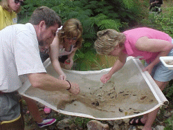 Your everyday actions, regardless of whether they are associated with activities where you live, work or play, can contribute to the quality of water that flows from your watershed. The Alabama Department of Environmental Management (ADEM), USDA Natural Resources Conservation Service (NRCS), U.S. Environmental Protection Agency (EPA), U.S. Geological Survey (USGS), and local citizen watershed or stream monitoring groups are the primary sources for information on the conditions of your watershed. These same agencies, plus additional organizations and educational institutions, are good sources of information on how you can help protect your watershed.
Alabama uses the USGS 8-digit Cataloging Unit (CU) watersheds as the spatial framework for defining its watershed assessment categories and for targeting the watersheds it views as its highest restoration priority. In most cases, only certain areas within an entire CU will show major water quality impairments. Alabama provides EPA with pinpoint data for reservoirs, streams, lakes or smaller water bodies that need management attention. Most of this information comes from the Unified Watershed Assessment and 303(d) list of impacted waters, which each state must provide to EPA as mandated by the Clean Water Act. Both EPA and ADEM make this information available to the public through the Internet. The EPA also maintains a directory of volunteer water quality monitoring programs.
For category and priority classification by 8-digit watersheds in Alabama, visit the EPA Watersheds.
To find specific information by 8-digit watersheds in Alabama, go to EPA's Surf Your Watershed web site (click on locate your watershed map, click on the map, click on Alabama, and then click on the watershed of choice).

